Error loading page.
Try refreshing the page. If that doesn't work, there may be a network issue, and you can use our self test page to see what's preventing the page from loading.
Learn more about possible network issues or contact support for more help.

Manhattan

Mapping the Story of an Island

ebook
1 of 1 copy available

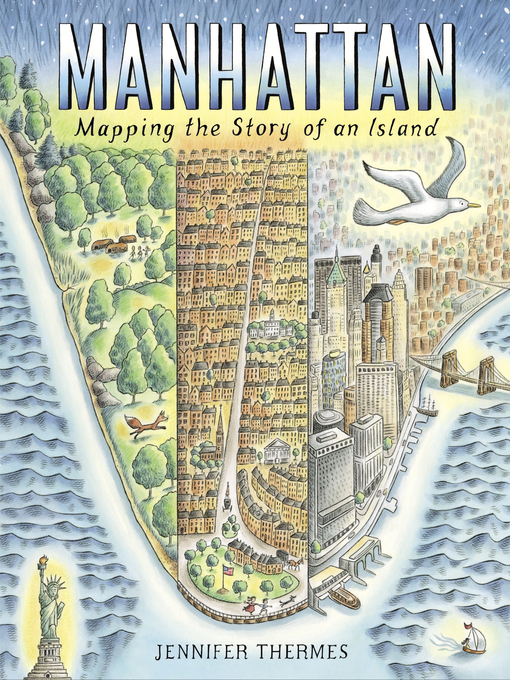
Told in dazzling maps and informative sidebars, Manhattan explores the 400+ year history of Manhattan Island.

From before its earliest settlement to the vibrant metropolis that exists today, the island of Manhattan has always been a place of struggle, growth, and radical transformation. Humans, history, and natural events have shaped this tiny sliver of land for more than 400 years. In Manhattan, travel back in time to discover how a small rodent began an era of rapid change for the island. Learn about immigration, the slave trade, and the people who built New York City. See how a street plan projected the city's future, and how epic fires and storms led to major feats of engineering above and below ground. Through dramatic illustrations, informative sidebars, and detailed maps inspired by historic archives, Manhattan explores the rich history that still draws people from all around the world to the island's shores today. From The Battery downtown up to Inwood, every inch of the island has a story to tell.

  • Creators

  • Publisher

  • Release date

  • Formats

    Kindle restrictions
  • Languages

  • Levels

  • Reviews

    • Publisher's Weekly

      Starred review from June 24, 2019
      The latest cartographic picture book from Thermes (Charles Darwin’s Around-the-World Adventure) maps Manhattan Island’s evolution from a glacially carved, flora- and fauna-rich wilderness into a bustling New York City borough. Full-page pictorial maps—befitting the book’s large trim size—document Manhattan’s south-to-north transformation. Ink-and-watercolor illustrations in soft hues depict the progression from villages of the Native Lenape people (who called the island Mannahatta) to colonial Dutch and British settlements and, finally, to a dense, diverse, skyscraper-filled city. Stylized birds fly banners with straightforward spread titles while sidebars frankly delineate the detrimental practices and impacts that its growth wrought on Native, African-American, and immigrant populations: spreads about Central Park and its many amenities are preceded by one recounting how African-American Seneca Village was demolished to make way for it. Also covered are some of Manhattan’s other notable stories: how the city got its street grid and famous subway; memorable natural disasters that befell it; and vignettes of how prominent skyscrapers and bridges were built. Like Manhattan itself, much is packed into this handsomely illustrated history. Back matter includes an extensive timeline and selected source list, while endpapers show a complete map of the modern city. Ages 8–12.

    • Kirkus

      Starred review from June 15, 2019
      Beavers, oysters, and elm trees; the Lenape people, those who were enslaved, and those who immigrated; and subways, skyscrapers, and Superstorm Sandy fill the pages of a street-by-street chronicle of this incredible island. Thermes opens with glaciers and moves on through the Mannahatta of the Lenape clans and the Manhattan of the Dutch and the English. Central to the formatting of both the book and New York City is the Plan of 1811 that established a grid pattern for the streets of the island north of Lower Manhattan. Central Park is developed, tenements are built to house poor immigrants, subways and bridges expand the island to neighboring locales, and tall buildings fill the horizon. Thermes does not shy from the violence of the city's history, providing, for instance, an informative sidebar about Seneca Village, established by free blacks and destroyed by eminent domain to build Central Park. The highlights of the book are the many sequential maps, drawn in watercolor, pencil, and ink. They include, in very legible hand-lettering, street names and references to sites mentioned in the text. Horses, dogs, and young children, both white and of color, stroll along. Other pages vary from full-page vistas of Central Park, fires, subways, and snowstorms to spot art featuring bridges, birds, and the harbor. The vibrant history that unfolds will hold children's attention through repeated viewings. (afterword, timeline, select sources) (Informational picture book. 7-10)

      COPYRIGHT(2019) Kirkus Reviews, ALL RIGHTS RESERVED.

    • School Library Journal

      Starred review from August 1, 2019

      Gr 3-7-Thermes presents the history of Manhattan from the time when glaciers covered the land to its contemporary prominence as a center of commerce, culture, and civilization through the use of maps, sidebars, and stories. From its hilly, swampy beginnings as a natural haven for birds and beavers to modern skyscrapers, subways, and parks, the island's unique history unfolds with colorful illustrations and accessible text. In the opening pages, Thermes reveals that Manhattan was originally home to the Lenape peoples and known as Mannahatta; she emphasizes the peoples who populated its ever-expanding boundaries. From the original Native peoples to the Dutch and English settlers to the countless immigrants and the African Americans who were enslaved, each group contributed to the city we know today. Much of the information offered concerns the natural world and the changes brought about by the ever-shifting needs of the populace. Surprisingly, although several natural catastrophes are shown, there is only a very brief mention of the 9/11 tragedy in the exhaustive time line offered in the appendix. A comprehensive bibliography suggests books, websites, museums, and a podcast for further information. VERDICT The maps, colorful illustrations, and accessible text present a comprehensive history of Manhattan as an island and a good introduction to the study of urban growth for students of all ages. Very valuable to students in the New York City metropolitan area, but also highly informative for all readers.-Eva Elisabeth VonAncken, formerly at Trinity-Pawling School, NY

      Copyright 2019 School Library Journal, LLC Used with permission.

    • Booklist

      Starred review from July 1, 2019
      Grades 3-6 *Starred Review* Thermes turns from mountains in Grandma Gatewood Hikes the Appalachian Trail (2018) to the history of Manhattan in this oversize, informational picture book. She begins chronologically with the Lenape, the first Native inhabitants, and continues with Henry Hudson's voyage, European colonization, the American and Industrial Revolutions, the Gilded Age, and the present. Throughout, the author considers their presence and impact of Native Americans, African American slaves and settlements, and immigrants on the overarching history of Manhattan. Because it's an island, Thermes highlights the surrounding waterways and animal life, such as the disappearance of beaver from overhunting in the 1800s and their return in 2007. An emphasis is placed on the city's development, from the grid plan of 1811 and the creation of Central Park to the subway system, iconic bridges, and skyscraper skyline. Disasters, including the Great Fire of 1835 and Hurricane Sandy in 2012, show how the city has continually adapted. The book's large scale is perfect for combining these descriptions with watercolor-and-pencil images that depict the island's evolution over time. Thermes, also a map illustrator, shows off her skills with detailed maps that reveal the origins of Broadway, Wall Street, and other landmarks. Endpapers sport a modern-day map of Manhattan, while a time line and other back matter concludes the text. This slice of American history is a gem.(Reprinted with permission of Booklist, copyright 2019, American Library Association.)

    • The Horn Book

      July 1, 2019
      In an oversized book, Thermes cartographically tells the story of what its Indigenous inhabitants, the Lenape, called Mannahatta. From Henry Hudson's 1609 voyage to the completion of One World Trade Center more than four centuries later, the history in the book is as much an abundance as its pictures: maps, vignettes, and full-page pictures of the changing city and its inhabitants, all confidently rendered in warm, precise watercolor-and-ink illustrations. Reading list, timeline.

      (Copyright 2019 by The Horn Book, Incorporated, Boston. All rights reserved.)

    • The Horn Book

      September 1, 2019
      In an oversized book recalling the glory days of the d'Aulaires, Thermes cartographically tells the story of what its Indigenous inhabitants, the Lenape, called Mannahatta. From Henry Hudson's 1609 voyage to the completion of One World Trade Center more than four centuries later, the history in the book is as much an abundance as its pictures: maps, yes, many, with the richness of detail enjoyed by map-lovers?but also vignettes and full-page pictures of the changing city and its inhabitants, all confidently rendered in warm, precise watercolor-and-ink illustrations. A comprehensive timeline and resource list are appended; endpapers divide a contemporary map of the island at 90th Street; under the jacket is a splendid homage to that quintessential Manhattan edifice, the skyscraper. roger Sutton

      (Copyright 2019 by The Horn Book, Incorporated, Boston. All rights reserved.)

Formats

  • Kindle Book
  • OverDrive Read
Kindle restrictions

Languages

  • English

Levels

  • ATOS Level:6.3
  • Lexile® Measure:1030
  • Interest Level:4-8(MG)
  • Text Difficulty:5-8

Loading
Check out what's being checked out right now This project is made possible by CW MARS member libraries, and the Massachusetts Board of Library Commissioners with funding from the Institute of Museum and Library Services and the Commonwealth of Massachusetts.